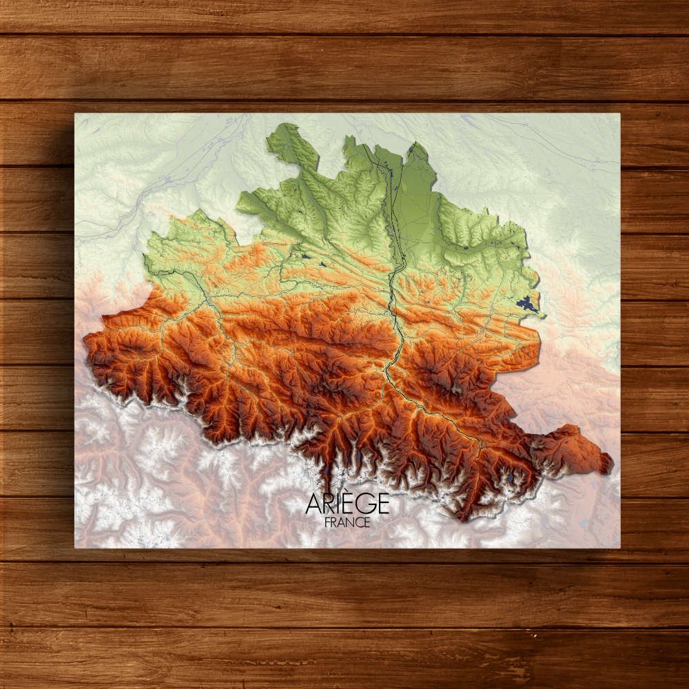
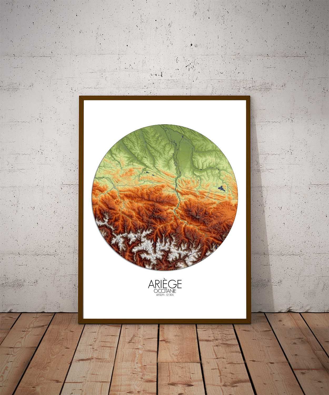
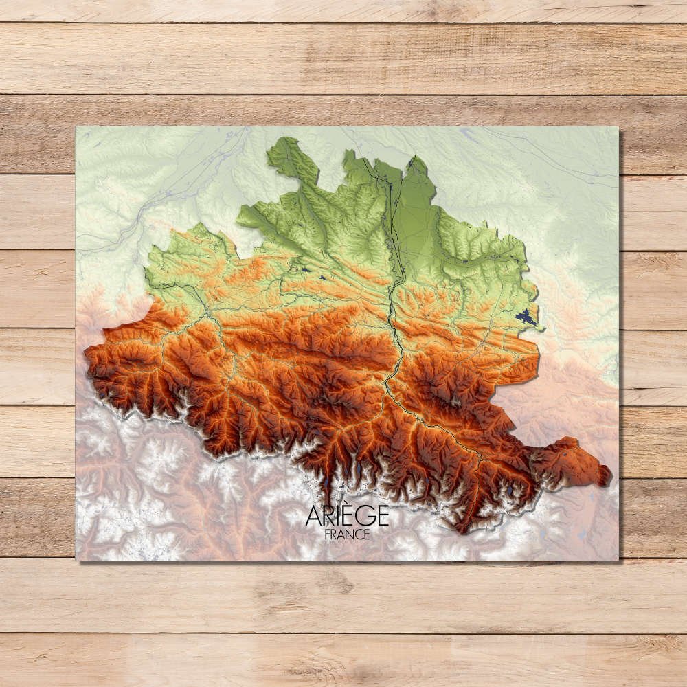
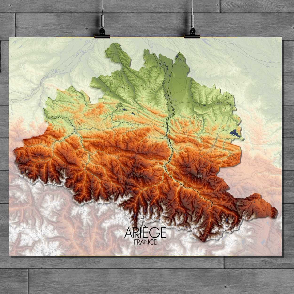
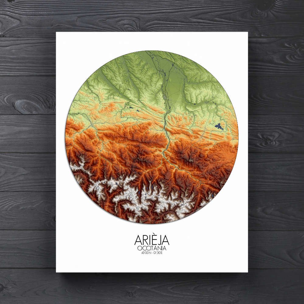
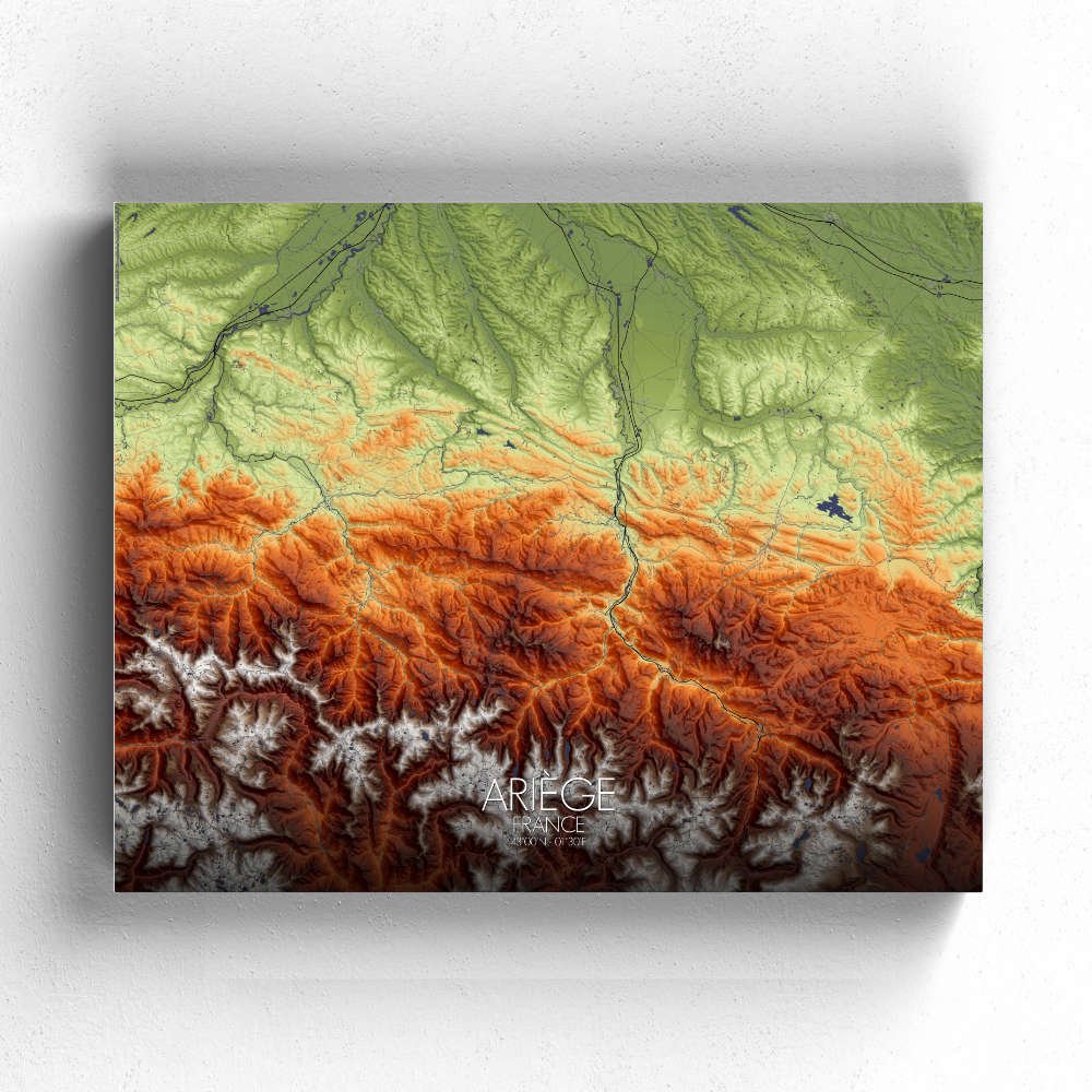
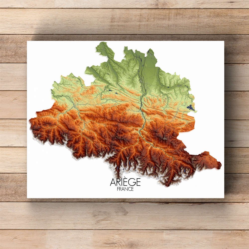
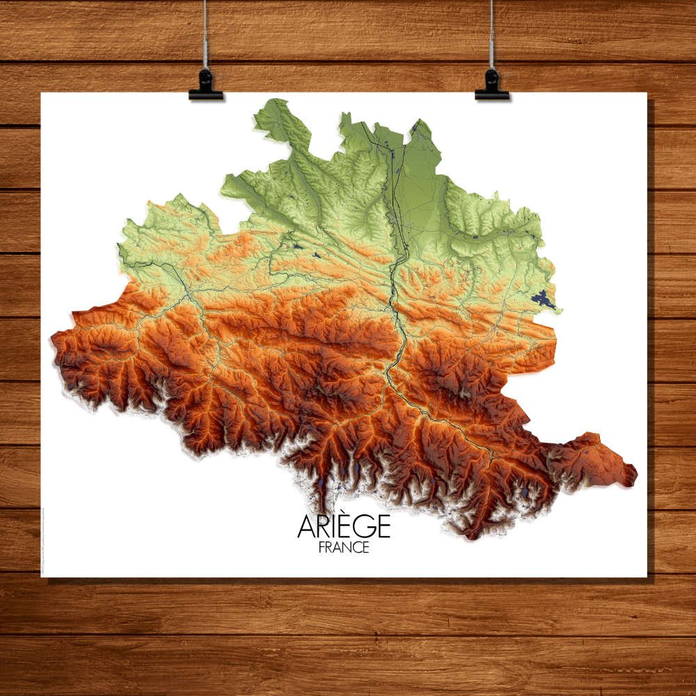
Poster City map of Ariège, France: Whether you’re drawn to the towering peaks or the quiet charm of the valleys, the map of Ariège will transport you to a place where the land itself tells the story of centuries past.
Situated in the foothills of the Pyrenees, Ariège is a landscape shaped by centuries of natural forces and human history. The map showcases the steep, twisting mountain ridges that define the area, with their high peaks and deep valleys, creating a topography that’s as adventurous as it is breathtaking. The rivers and streams carve their way through the land, leading to quiet, hidden gorges and valleys, perfect for explorers or those looking for a peaceful retreat. What makes this map particularly captivating are the gentle slopes of its rolling hills, dotted with the occasional patch of forest or expansive pasture. The rural landscape is alive with greenspaces, offering a contrast to the rugged mountains. The area is famous for its medieval villages, with ancient stone structures that still stand as if waiting for a local knight or two to stroll by. Historic landmarks, like the Château de Foix, sit proudly amidst the natural beauty, adding a touch of grandeur to the serene countryside. It’s a region steeped in history, where ancient tales of Cathar castles, hidden treasures, and the spirit of the Pyrenean landscape come alive through the map’s elevations. It’s a perfect blend of nature’s grandeur and human legacy, making this map a timeless piece of art for any wall.