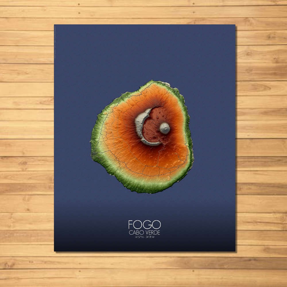
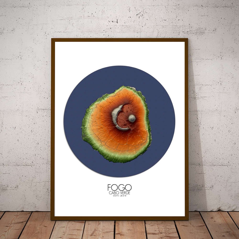
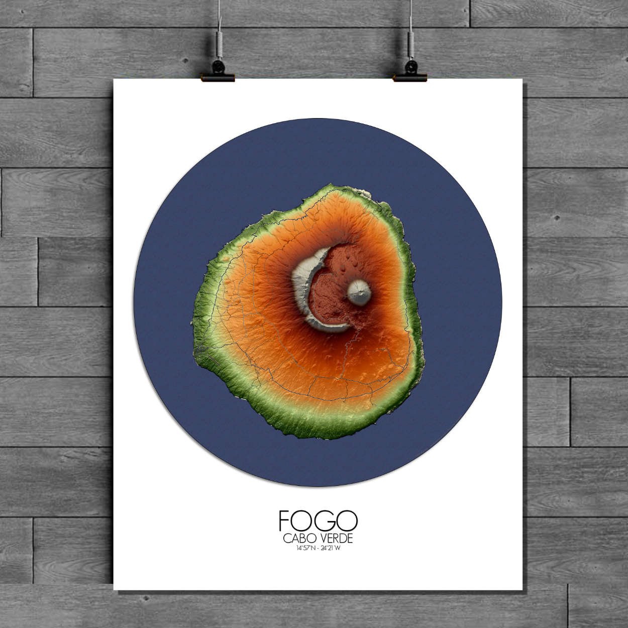


Poster of Elevation map of Fogo, Cabo Verde: not just a land of fire, but of life. The map showcases the island’s diverse ecosystems, from the arid stretches of volcanic rock to the verdant, fertile areas where farmers cultivate everything from coffee to bananas.
Fogo, named for its fiery, volcanic origins, is a place where nature’s power is still felt, and where the earth’s deep geological scars have given rise to one of the most dramatic and beautiful islands in the archipelago. This map captures the rugged charm of the land, with every peak, valley, and crater telling a story of ancient fire and untamed nature. At the heart of the map lies the island’s most iconic feature—the mighty Pico do Fogo, an active volcano that rises a towering 2,829 meters above sea level. This majestic peak, depicted with stunning topographical precision, dominates the island’s landscape. Whether you see it as a formidable giant or a peaceful guardian, Pico do Fogo is the beating heart of the island, and the map brings out its grandeur in all its fiery glory. The surrounding lava fields, black and stark, offer a striking contrast to the softer greens and browns of the lower slopes, where rich volcanic soil has nurtured an array of vineyards and farms. The island’s terrain is a beautiful mix of rugged mountains, fertile valleys, and sharp cliffs. As you trace the contours of Fogo, you’ll notice the deep ravines, ribeiras, which carve through the island like ancient scars, winding their way from the volcanic heights down to the coast. These lush green valleys are home to charming villages, including the island’s main town, São Filipe, which rests on the southwestern coast. São Filipe itself, with its historical charm and colonial architecture, is a delightful spot where cobblestone streets meet the backdrop of the volcanic peaks. It’s a town that has witnessed centuries of change, from the island’s earliest settlers to its more modern role as the island’s cultural and economic hub. The island’s microclimates, shaped by the altitude and geography, create pockets of greenery even in places that seem otherwise inhospitable. The lower regions, particularly around São Filipe, are rich with lush hillsides, while the higher altitudes, like the Chã das Caldeiras, offer sweeping views and a more stark, yet equally captivating beauty. Fogo is a place where the earth seems to hum with ancient energy, and this map brings all that energy to life in your home.