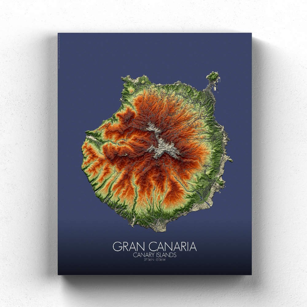
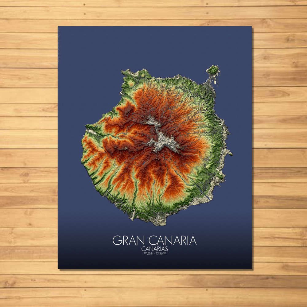
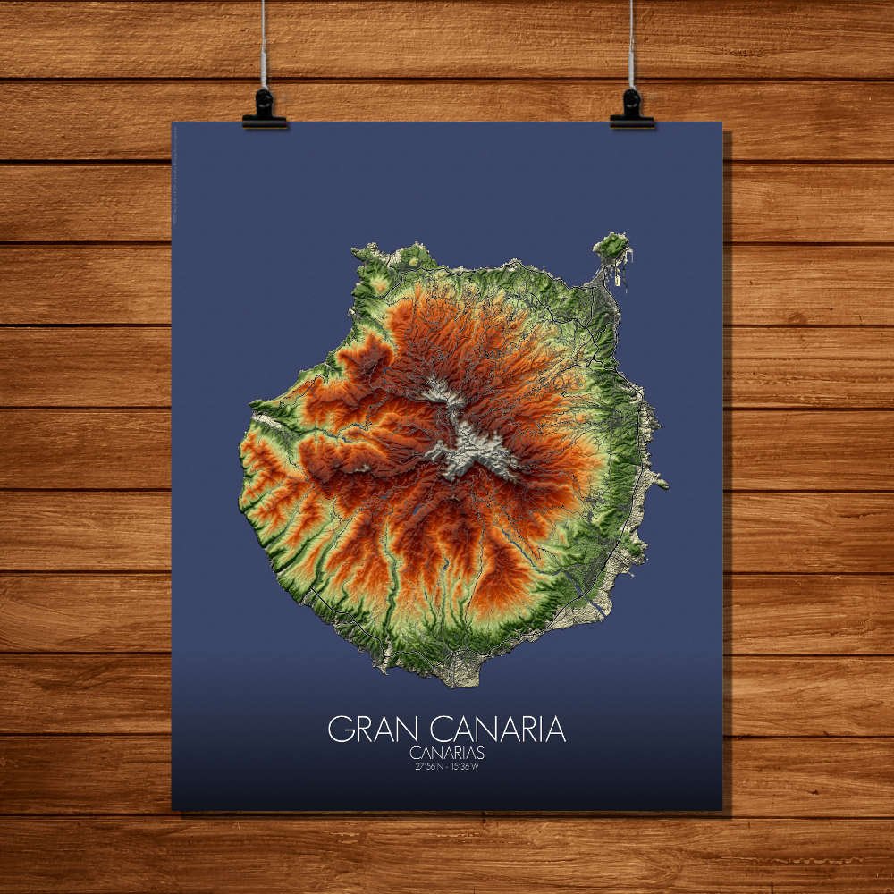
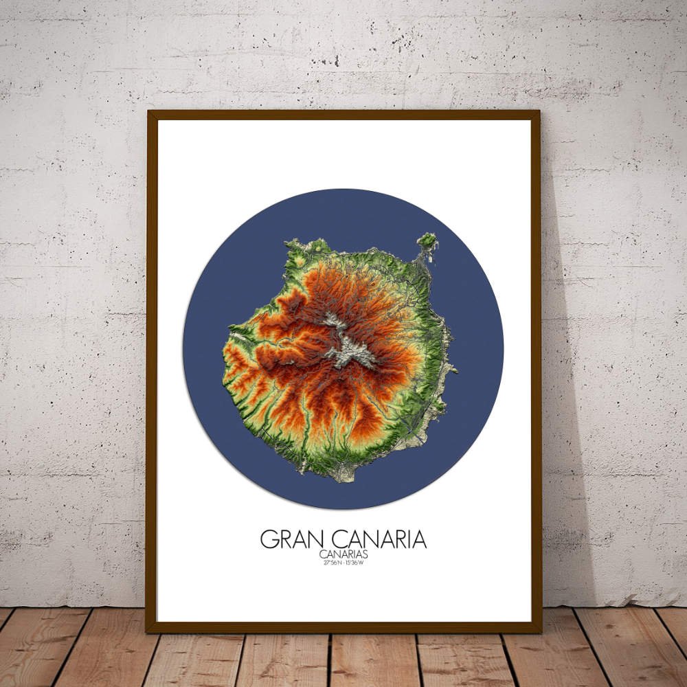
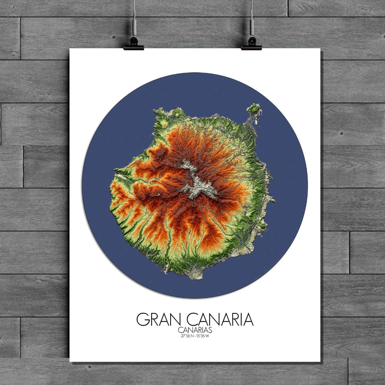
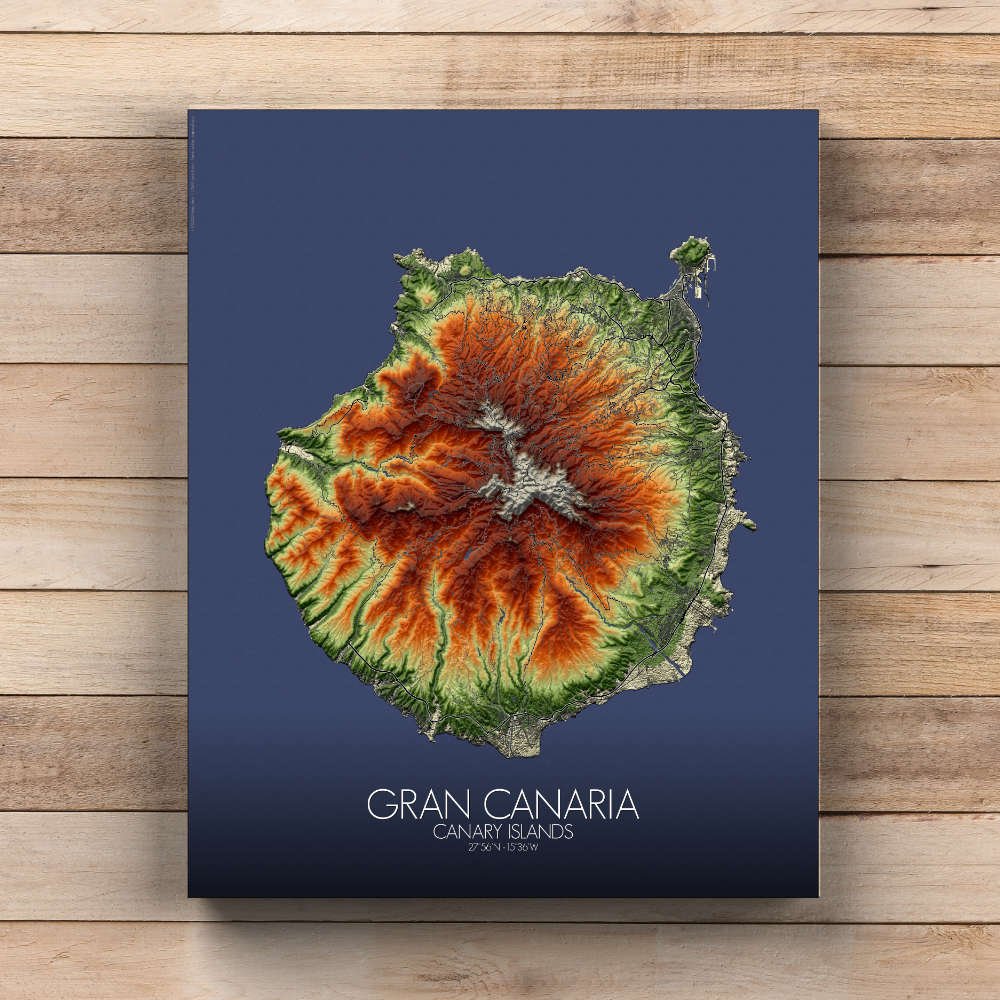
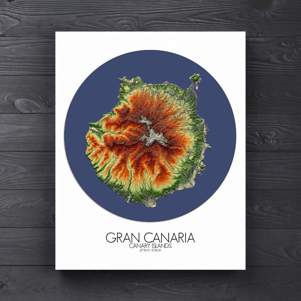
Poster of Elevation map of Gran Canaria, Canary Islands: a blend of contrasting extremes with a dry, sun-baked southern coast, home to golden sand dunes and the lush, verdant north, where the forests and wildflower-covered hills seem to stretch endlessly.
Gran Canaria, often called “a continent in miniature,” is an island where the land itself seems to tell a thousand stories. From its soaring mountains to its golden beaches, this city map beautifully captures the island’s remarkable topography, with every valley, ridge, and cliff immortalized in rich detail. With a landscape as varied as its history, Gran Canaria offers a visual feast for the eyes, from the rugged volcanic heart of the island to the lush, green ravines of the north, where the land seems to be alive with ancient whispers. At the center of the island rises the towering Pico de las Nieves, Gran Canaria’s highest peak, an ancient volcano that watches over the island like a silent sentinel. The map’s contours highlight the island’s sharp, dramatic valleys and deep ravines—some of which seem to slice through the land like nature’s own artistry. These canyons, such as the stunning Barranco de Guayadeque, are rich with history and natural beauty, offering a glimpse into the island’s indigenous past. It is said that the Guanches, the original inhabitants, once lived in caves carved into these cliffs, making the landscape not just a geological wonder, but a cultural treasure as well. The map brings these differences to life, with shaded contours that bring out the island’s wild beauty—each region distinctive, yet undeniably Gran Canarian. The highlands, dotted with pine forests, are a haven for nature lovers, while the coast boasts the kind of beaches that make you wonder if paradise might just exist after all.