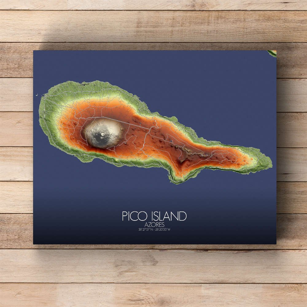

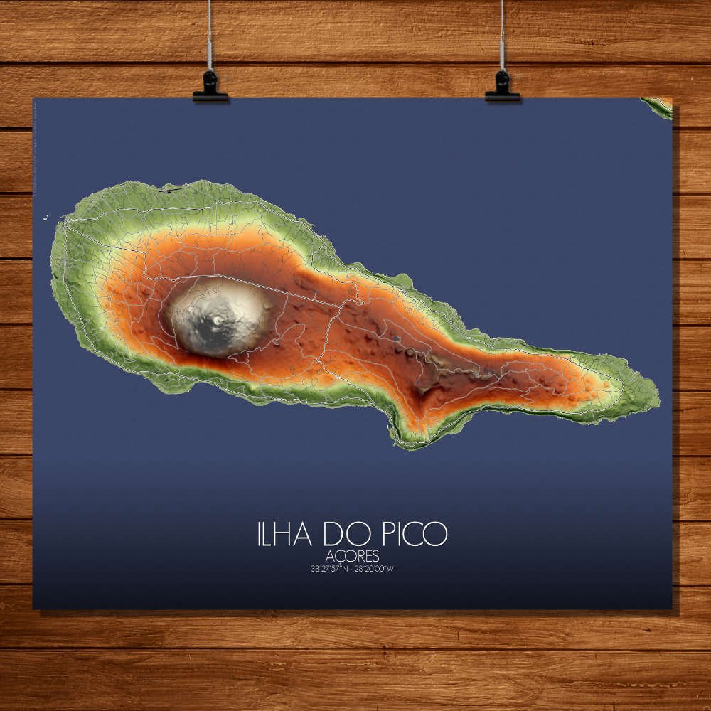
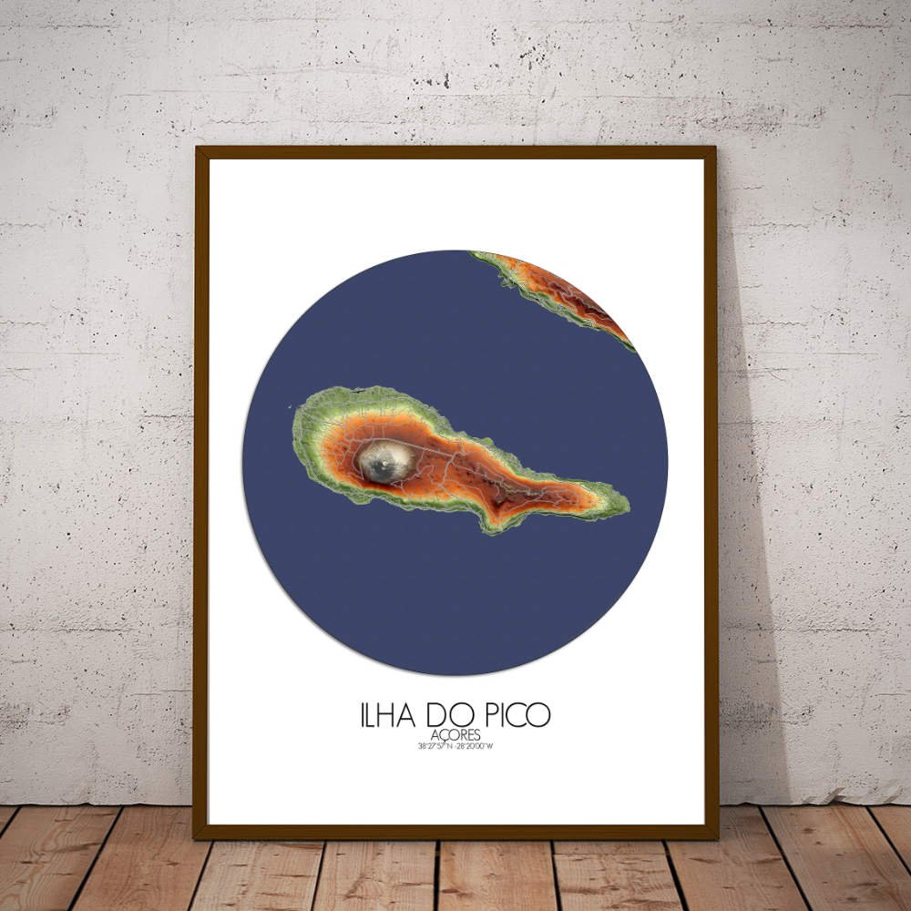
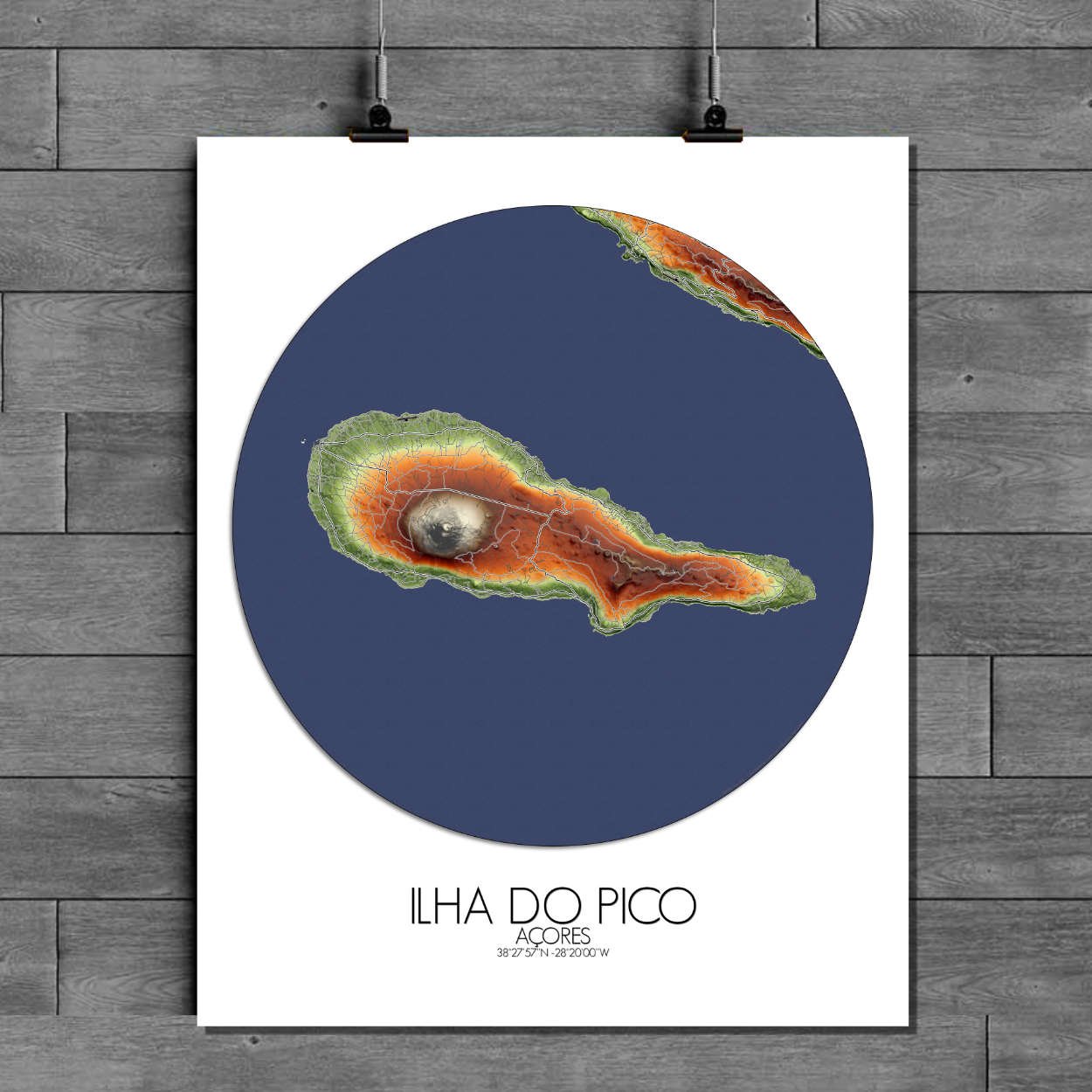
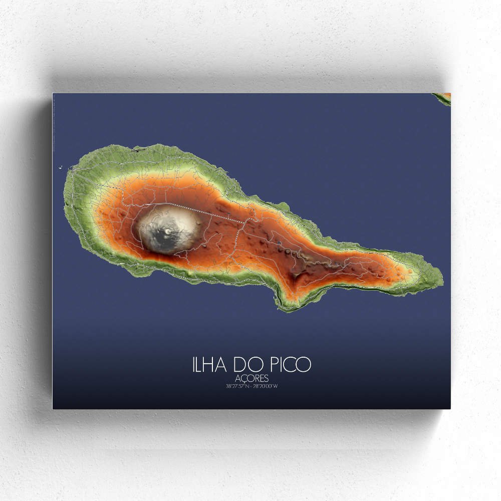
Poster of Elevation map of Ilha do Pico, Azores: assuming the peaceful, almost mystical atmosphere of this island, this map will transport you to a place where the earth meets the sky, and every ridge and valley holds a story waiting to be discovered.
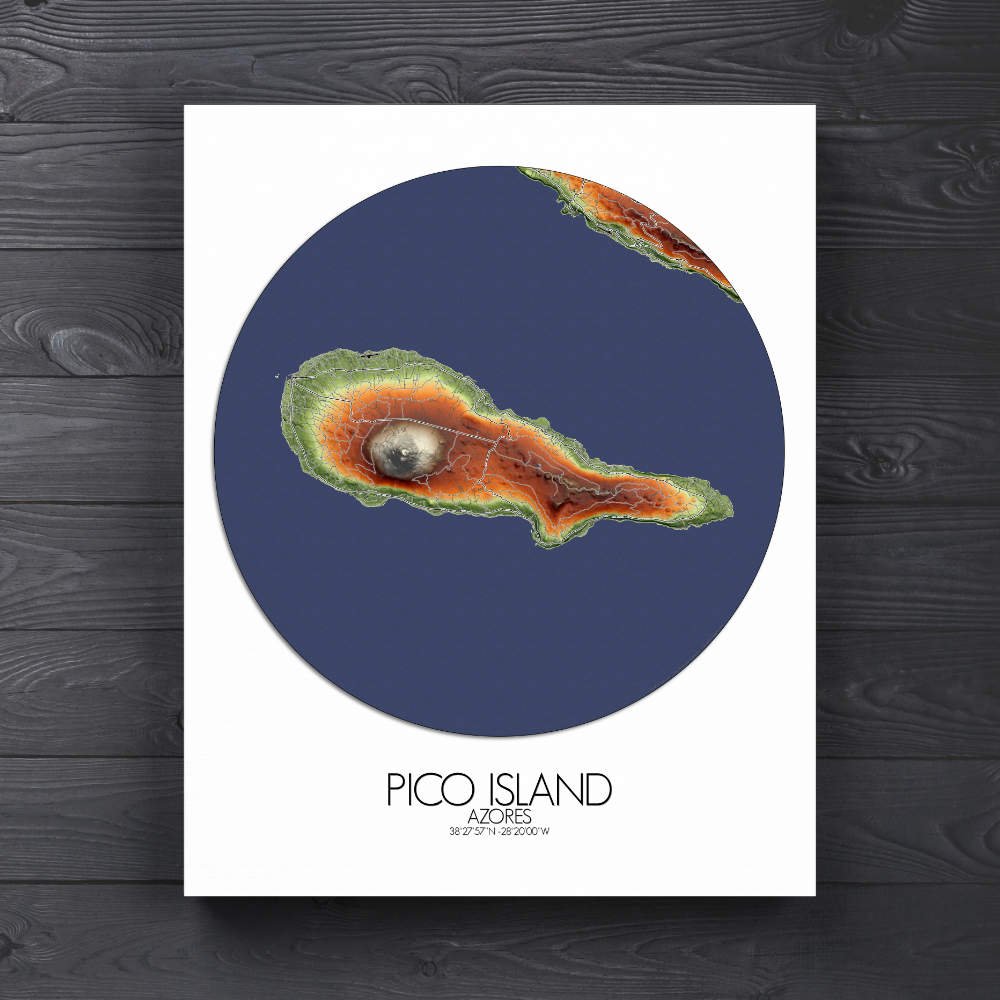
Ilha do Pico, the proud “mountain island” of the Azores, is a stunning elevation map that beautifully captures the island’s dramatic topography, showcasing every twist and turn of its volcanic landscape, from its towering, almost otherworldly peak to the lush valleys and rugged coastline below. Pico’s centerpiece is, of course, its imposing volcano, Mount Pico, rising to a majestic 2,351 meters, making it the highest mountain in Portugal. The map’s detailed contours bring out the mountain’s powerful presence, a dormant giant that has shaped not just the island’s land but also its culture and identity. The slopes of Mount Pico are covered in rich greenspaces—dense forests and pastures dotted with the iconic stone-walled vineyards that have earned Pico UNESCO recognition for its unique landscape. The intricate network of terraces created by generations of farmers seems to stretch forever, a testament to the island’s deep connection to the land. These terraced vineyards, producing the famous Pico wine, add a beautiful, almost geometric pattern to the map, reminding us of the island’s quiet resilience and its history as a hub of maritime exploration. The port town of Madalena, with its picturesque harbor, is a key landmark, acting as the gateway to the island for visitors and a vibrant hub for its fishing community. From here, you can look across the water to the nearby island of Faial, the “sister island,” whose dramatic landscape seems to watch over Pico with an eternal, protective gaze.