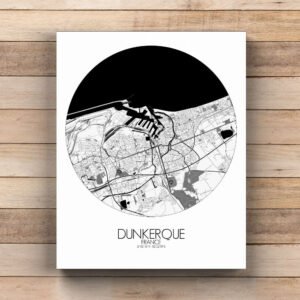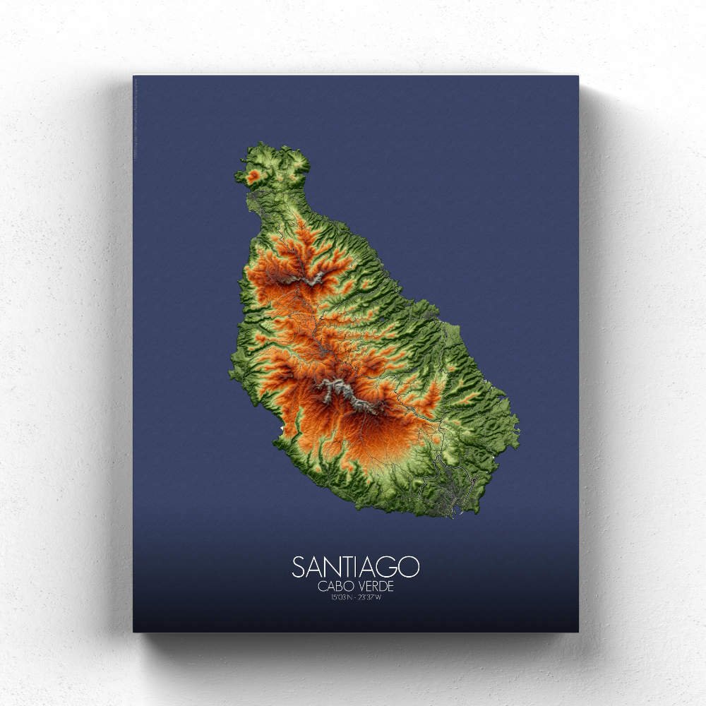
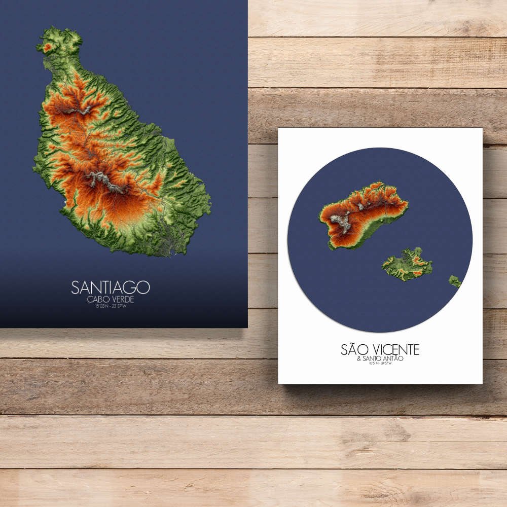
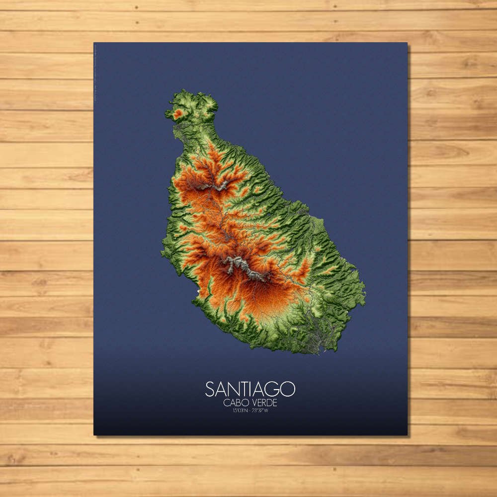
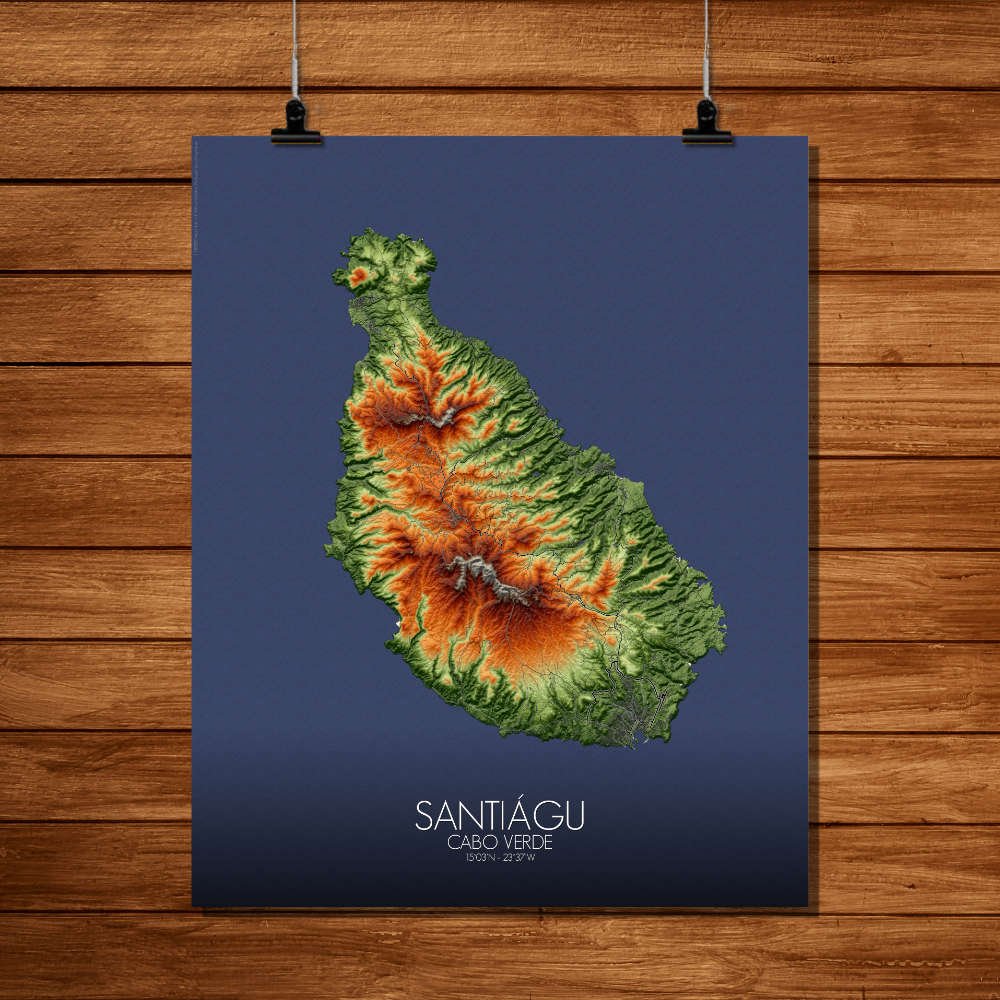

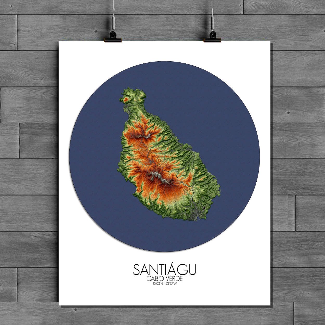
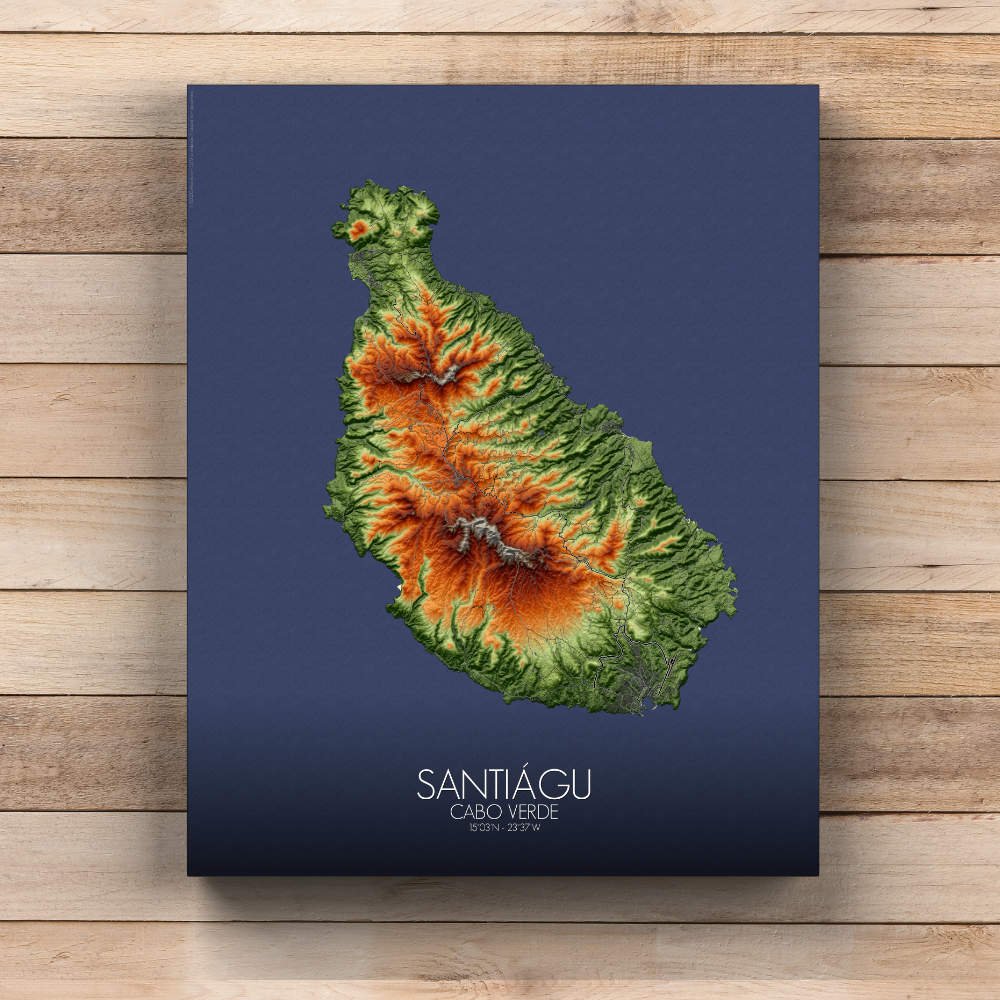

Poster of Elevation map of Santiago, Cabo Verde: birthplace of Cabo Verde’s independence, this map carries the weight of that history in every curve of its terrain.
Santiago, the largest and most populous island in the Cabo Verde archipelago, is a place where history, culture, and nature intertwine in a landscape that is both stunning and diverse. The heart of the island is its mountainous core, where the towering peaks of Pico da Antónia and Pico de Forno rise dramatically above the island’s lower lands. These majestic mountains, captured beautifully in topographic detail, provide not only the island’s natural backbone but also a sense of awe. The peaks are often covered in mist, giving them a mystical, almost otherworldly quality. From these heights, the view stretches across the island, offering glimpses of the patchwork of green valleys below and the sprawling coastal plains that lead to the Atlantic. The map highlights the vibrant Ribeira de S. Jorge and Ribeira da Barca, where water flows through verdant canyons, carving paths through the volcanic rock. These valleys are the island’s agricultural heart, producing everything from bananas to sugarcane, and are dotted with small, traditional villages where life moves at a slower pace, in harmony with the land. The gentle hillsides of Assomada and Santa Catarina are home to fertile farms and terraced fields, creating a patchwork of greens that stand out against the more rugged highlands. Then there is the island’s coastline, where the map captures the sweeping beaches of Tarrafal and the bustling harbor city of Praia, the island’s capital. Praia, perched on the southern coast, is the island’s political, economic, and cultural hub. Its streets tell stories of colonialism, independence, and modern development. The map delicately outlines the city’s coastal growth, from the old town near the Plateau to the more contemporary areas along the shoreline. The harbor itself, with its boats and trade routes, has witnessed centuries of sailors, traders, and explorers passing through. The map captures this essence, with the blue of the Atlantic mixing seamlessly with the grid of streets, creating a visual harmony between land and sea.