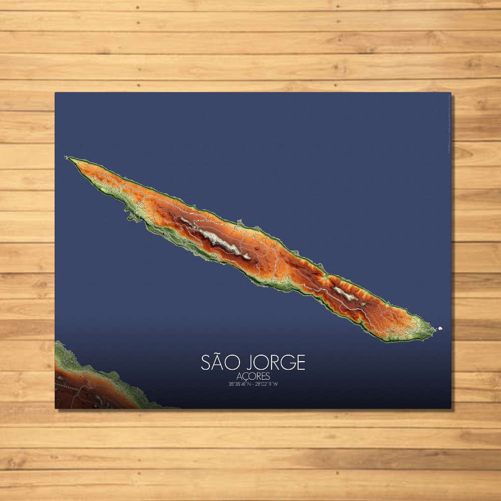


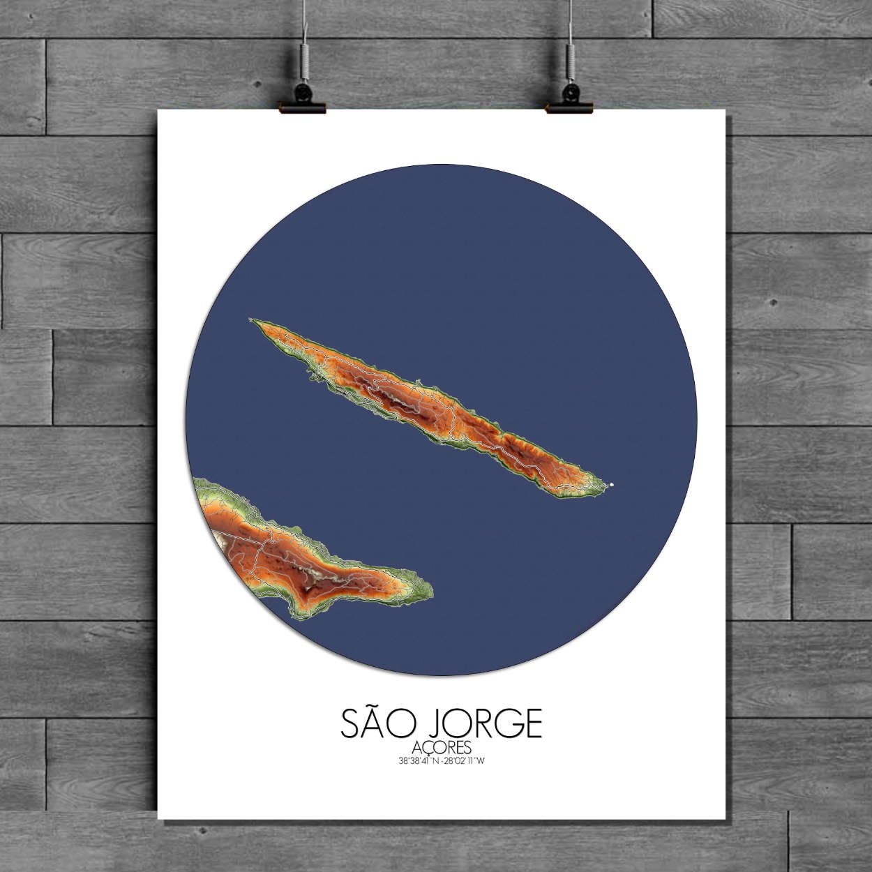
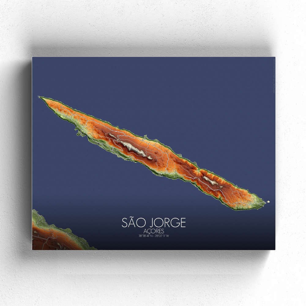
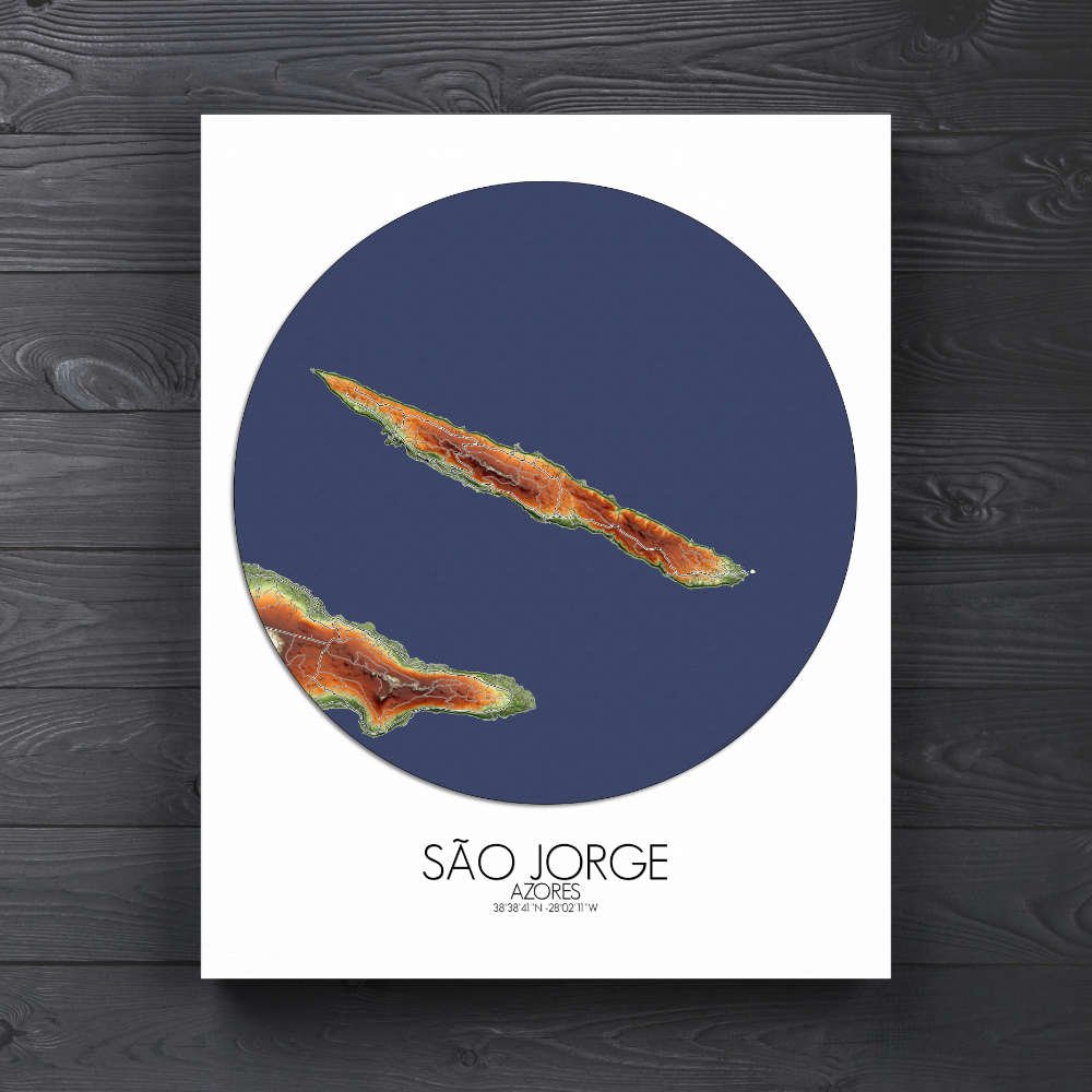
Poster of Elevation map of Sao Jorge, Azores: this map captures the island’s rugged beauty in rich topographic detail, offering a unique view of the terrain that is both artistic and informative.
Nestled in the heart of the Azores, São Jorge is an island that feels as if it were plucked from a storybook, with its striking cliffs, lush landscapes, and the timeless dance of the ocean around its shores. From its soaring volcanic mountains to its serene valleys, São Jorge’s geography is nothing short of dramatic. The map showcases the island’s distinct “fajãs” — those fertile coastal plateaus formed by ancient lava flows — where villagers have cultivated their land for centuries, in scenes so picturesque they might make you wish you could step into the frame. The rolling hills and valleys are covered with dense, vibrant green forests, and the map’s design allows the play of shadows and contours to highlight São Jorge’s natural splendor, from the deep ravines to the peaceful pastures. Towering peaks, like the Pico da Esperança, seem to touch the sky, while the jagged coastline promises hidden caves and secluded beaches that only the most adventurous can reach. Landmarks like the Church of Santa Bárbara, with its whitewashed walls standing against the island’s greenery, and the impressive fortress at Forte de São João Baptista, offer glimpses of the island’s storied past.