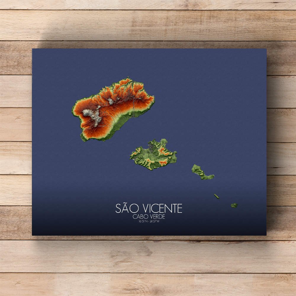
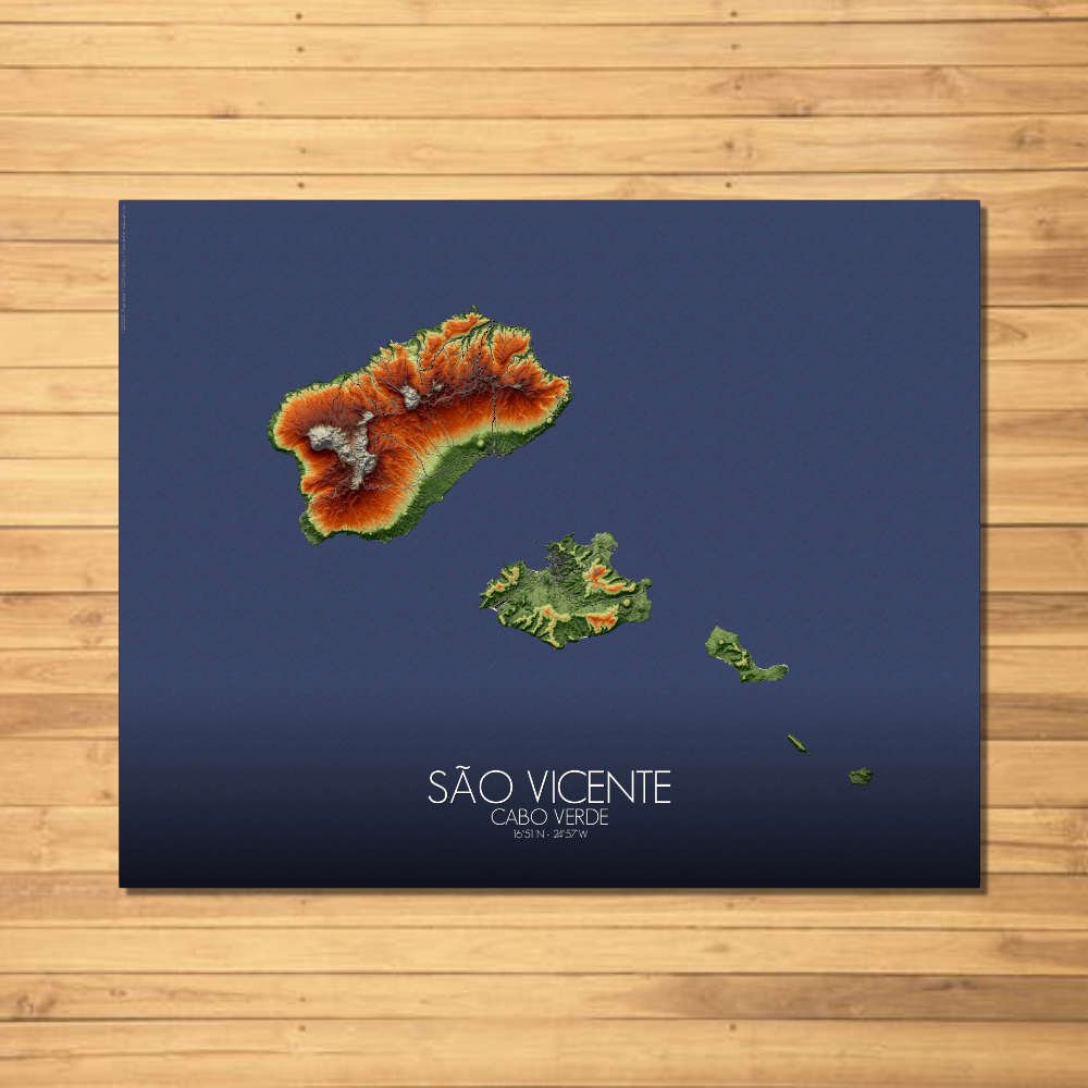
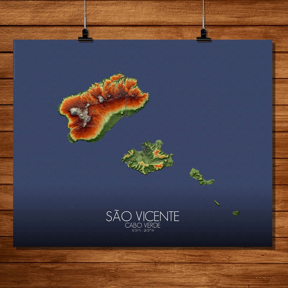
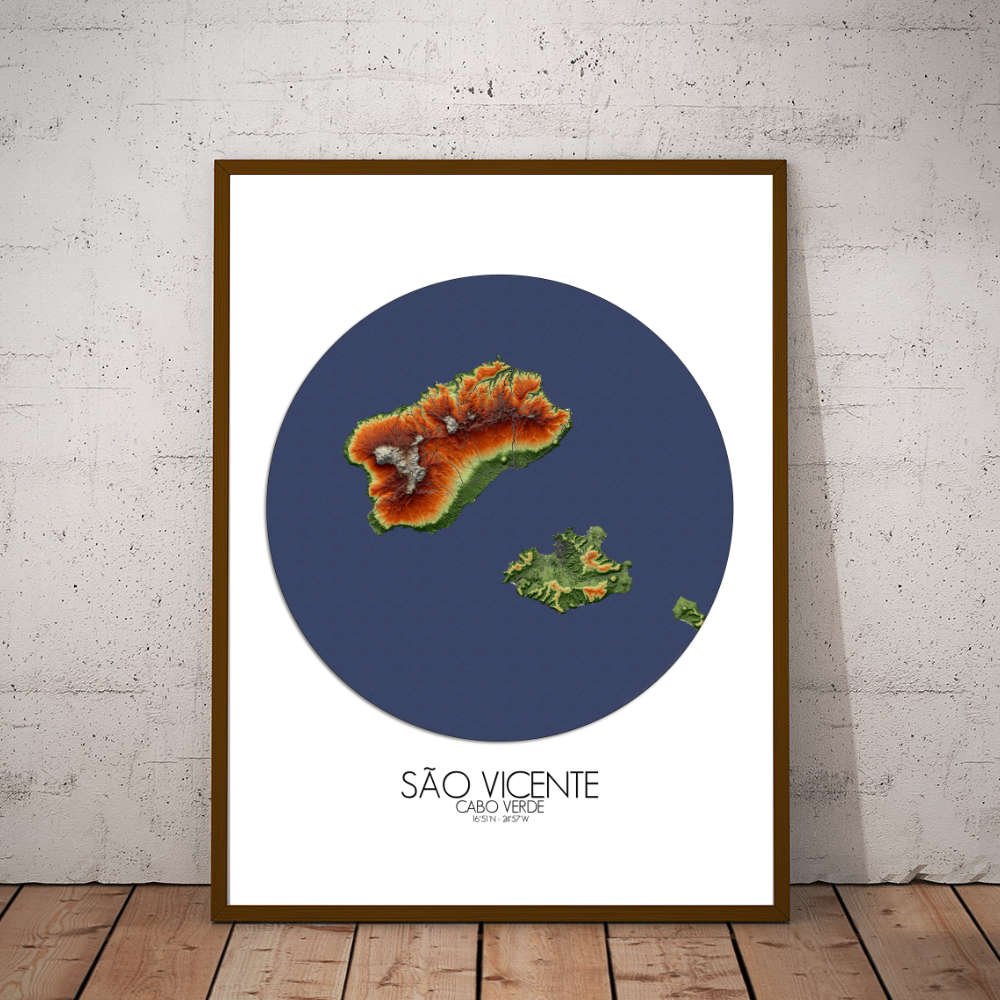
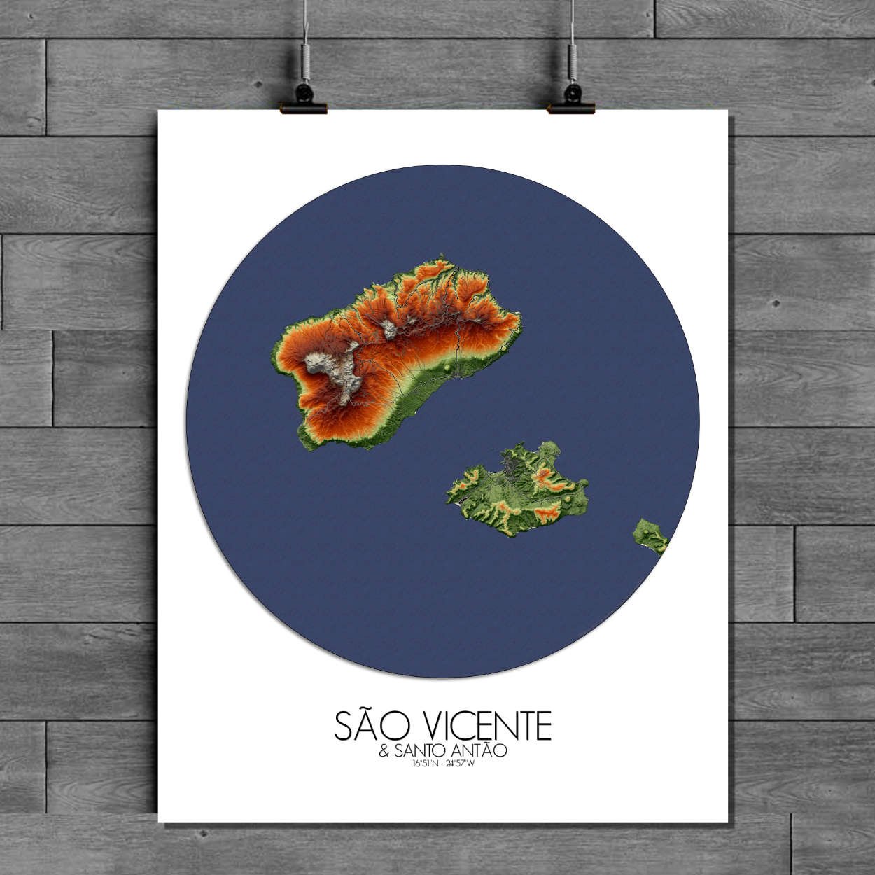
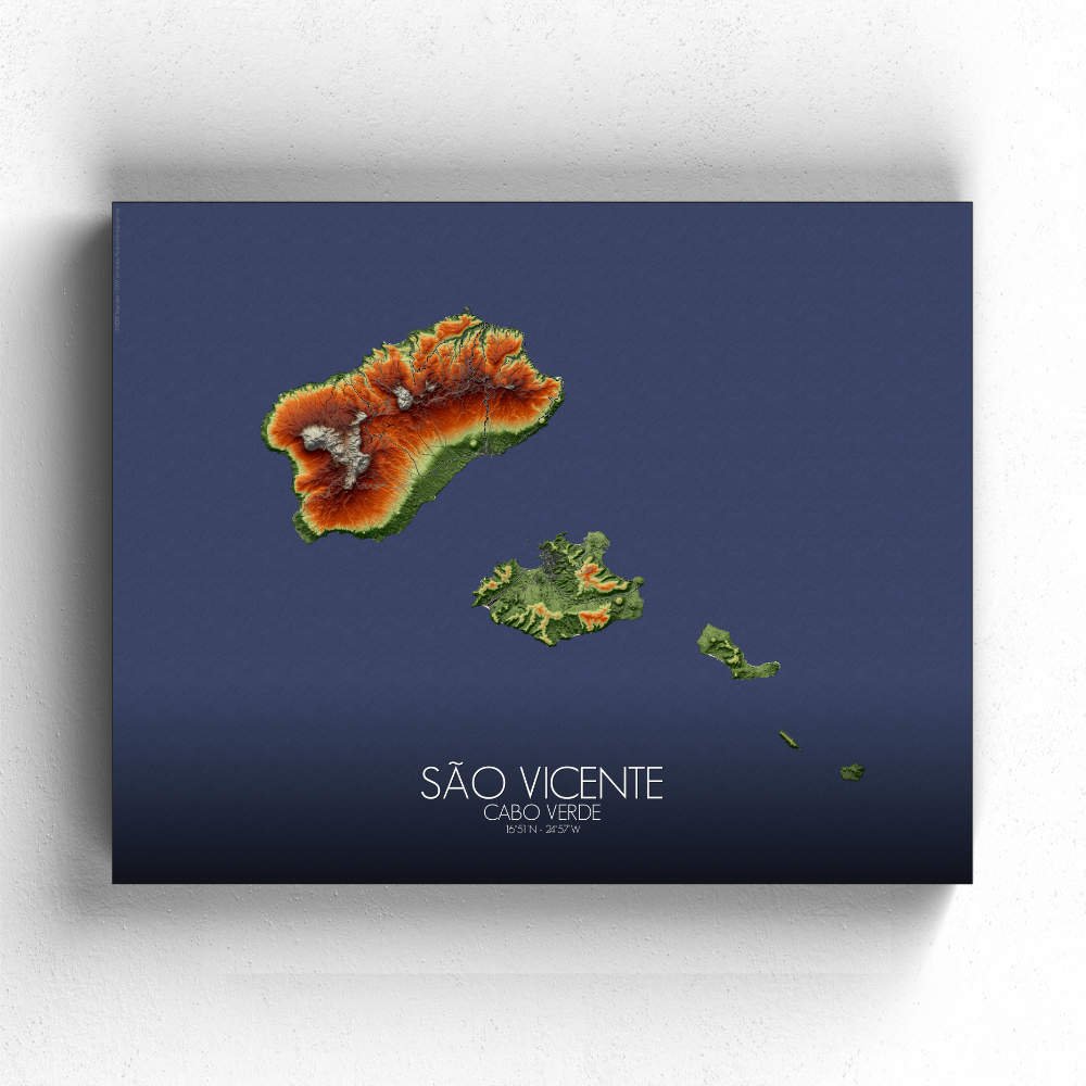
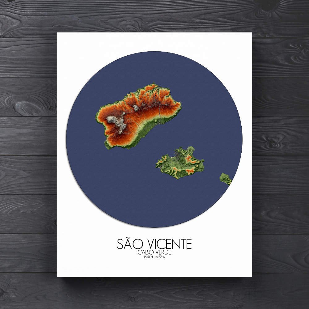
Poster of Elevation map of Sao Vicente, Cabo Verde: It’s a place where the hills tell stories, where the sea whispers of trade and adventure, and where every corner offers a new discovery.
Sao Vicente is an island that wears its unique character proudly: shaped by the wind, the sea, and the timeless dance of volcanic forces. This map is not merely a guide to the city, but a carefully crafted artwork, showcasing the island’s striking topography and the places that have made it one of the most iconic destinations in the Cabo Verde archipelago. At the heart of the map, you’ll find the island’s famous bay, Baía do Porto Grande, a sweeping crescent of water embraced by towering hills. The bay is one of those rare natural harbors that not only holds the history of sailors who’ve anchored here for centuries, but also offers one of the most visually arresting views in all of Cabo Verde. The land slopes upwards from the water, forming dramatic cliffs that give Sao Vicente its raw, rugged charm. These hills, some of them crowned with rocky outcrops, create an impressive backdrop for the bustling streets of Mindelo, the island’s cultural and economic heart. The Monte Verde, with its misty heights, stands tall, adding a splash of verdant green to the predominantly arid landscape. The gentle slopes of this peak offer a different side of Sao Vicente: cool, breezy, and unexpectedly lush compared to the island’s drier stretches. It’s a land of contrasts, and this map highlights them all. The island’s coastline, marked with small coves and sandy beaches, is dotted with charming fishing villages and coastal landmarks that have stood for generations. The map makes these stretches of coast stand out, from the sleepy village of Calhau to the more energetic shores of Laginha, where the sea and the sky seem to meet in endless blue. The contrast of ocean and land—smooth beaches and jagged cliffs—makes Sao Vicente’s landscape one of Cabo Verde’s most visually diverse.